

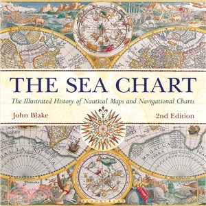
The Sea Chart ─ The Illustrated History of Nautical Maps and Navigational Charts
- ISBN13:9781844863143
- 出版社:Conway Maritime Pr
- 作者:John Blake
- 裝訂/頁數:精裝/192頁
- 規格:30.5cm*30.5cm*2.5cm (高/寬/厚)
- 版次:2
- 出版日:2016/05/17
商品簡介
Ocean sailing needed skill, courage, and experience, and the sea chart was the tool by which ships of trade, transport, or conquest navigated. This examines the history and development of the chart and the nautical map, in both scientific and aesthetic terms as a means of safe and accurate seaborne navigation. The Italian merchant-venturers of the early thirteenth century developed the earliest "portolan" pilot charts of the Mediterranean. The subsequent speed of exploration by European seafarers to the New World, around the Cape of Good Hope, and on trade routes to the East, India, and the Spice Islands were results of the development of the sea chart. By the eighteenth century, the discovery and charting of the coasts and oceans of the globe had become a strategic naval and commercial requirement. Such involvements led to Cook's voyages in the Pacific, the search for the Northwest Passage, and races to the Arctic and Antarctic.
The volume is arranged along chronological and geographical lines. Each of the ten chapters is split into distinct halves, examining the history of charting a particular region and the context under which such charting took place, followed with specific navigational charts and other relevant illustrations. Key figures or milestones in the history of charting are then presented in stand-alone story box features.
This new edition features forty new charts and accompanying text.
作者簡介


您曾經瀏覽過的商品

購物須知
外文書商品之書封,為出版社提供之樣本。實際出貨商品,以出版社所提供之現有版本為主。部份書籍,因出版社供應狀況特殊,匯率將依實際狀況做調整。
無庫存之商品,在您完成訂單程序之後,將以空運的方式為你下單調貨。為了縮短等待的時間,建議您將外文書與其他商品分開下單,以獲得最快的取貨速度,平均調貨時間為1~2個月。
為了保護您的權益,「三民網路書店」提供會員七日商品鑑賞期(收到商品為起始日)。
若要辦理退貨,請在商品鑑賞期內寄回,且商品必須是全新狀態與完整包裝(商品、附件、發票、隨貨贈品等)否則恕不接受退貨。