Gripping firsthand accounts Then-and-now photos of the veterans Maps and sidebars highlighting battles, units, and equipment Thirty veterans of World War II from Pennsylvania recall their time of serv
Described by the TLS as 'a formidable bibliographical achievement … destined to become a key reference work for Shakespeareans', Shakespeare in Print is now issued in a revised and expanded edition offering a wealth of new material, including a chapter which maps the history of digital editions from the earliest computer-generated texts to the very latest digital resources. Murphy's narrative offers a masterful overview of the history of Shakespeare publishing and editing, teasing out the greater cultural significance of the ways in which the plays and poems have been disseminated and received over the centuries from Shakespeare's time to our own. The opening chapters have been completely rewritten to offer close engagement with the careers of the network of publishers and printers who first brought Shakespeare to print, additional material has been added to all chapters, and the chronological appendix has been updated and expanded.
In the last two decades, human rights law has played an expanding role in the legal regulation of wartime conduct. In the process, human rights law and international humanitarian law have developed a complicated sibling relationship. For some, this relationship is viewed as a mutually reinforcing effort between like-minded regimes designed to civilize human behavior. For others, the relationship is a more complicated sibling rivalry. In this book, an unparalleled collection of legal theorists examine the relationship between these two bodies of law. Each chapter skilfully maps the possibilities of harmonization while, at the same time, raising cautionary flags about the limits of that project. The authors not only chart the existing state of the law, but also debate the normative implications of the continuing influence of human rights norms on current practices including torture, targeted killings, the conduct of non-international armed conflicts, and post-war state building.
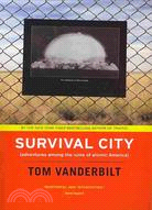
On the road to Survival City, Tom Vanderbilt maps the visible and invisible legacies of the cold war, exhuming the blueprints for the apocalypse we once envisioned and chronicling a time when we al
This reference provides comprehensive information on the taxonomy and distribution in time and space of all currently recognized southern African fossil mammals. After an introductory background chapter on southern Africa, mammals, sites and dating, the following chapters are presented by epoch, covering the Eocene, Miocene, Pliocene, Pleistocene and Holocene. Individual maps provide information on where in the landscape specific taxa have been found, and a comprehensive index lists all the fauna and site locations. The book ends with a chapter on how the book can be used, and lines of future research. Collecting a vast amount of information together in an accessible format, this is an essential reference for non-specialist taxonomists and palaeontologists, as well as for those using fossil data for other applications, such as archaeology, neontology and nature conservation. This title is also available as Open Access on Cambridge Core.
Travel back in time and find out about the first weapons and their uses, and about the lives of the people who used them. Vivid illustrations, maps and photographs bring history to life.
Covering the first five decades of the exploration of Mars, this atlas is the most detailed visual reference available. It brings together, for the first time, a wealth of information from diverse sources, featuring annotated maps, photographs, tables and detailed descriptions of every Mars mission in chronological order, from the dawn of the space age to Mars Express. Special attention is given to landing site selection, including reference to some missions that were planned but never flew. Phobos and Deimos, the tiny moons of Mars, are covered in a separate section. Contemporary maps reveal our improving knowledge of the planet's surface through the latter half of the twentieth century. Written in non-technical language, this atlas is a unique resource for anyone interested in planetary sciences, the history of space exploration and cartography, while the detailed bibliography and chart data are especially useful for academic researchers and students.
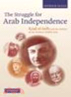
The Middle East, as we know it today, was shaped in the violent and tumultuous years of the first half of the 20th century. The roots of many of the conflicts and crises which afflict the region today can be traced back to this period of wars, high drama and the cavalier re-drawing of maps. Patrick Seale, a leading historian of the region, tells the story of the making of the modern Middle East through the life of Riad el-Solh, a Lebanese politician who grew into the outstanding Arab statesman of his time. Based on British and French archives, and on numerous interviews, the book pieces together the history of the Arab struggle for independence through the lives of those most directly involved. It is an invaluable resource for students and researchers, and of compelling interest to anyone who wants to know more about the Middle East.
Mapping Asia presents an authoritative selection of the most important antique maps of Asia representing time periods from the age of Alexander the Great to the early nineteenth century, and spanning
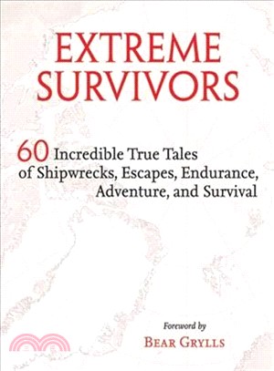
Collected for the first time in one volume are history’s most legendary survival stories. Statistics, descriptions, archive photographs, and illustrative maps reveal the shocking details of how Joe Si
This book is a major study of visual representations of Europe, from the classical world to the present day, in maps, icons, the arts and graphic images of all kinds. Europe has been variously represented as the demi-goddess Europa, a bull, a horse, a son of Noah, a Magus, a queen, and the Empress of the World. This richly illustrated book charts how these visualizations of the continent have altered over time; how they interact with changing ideas of the extent and nature of Europe in relation to the other continents; and how these images have influenced and been influenced by the 'reality' of Europe. Spanning the ages from the Ancient Greeks to the European Union, this history of three millennia of Europe and its representations is an important contribution to ongoing debates about the nature of European identity.
Why are some parts of the world poor today, while others are rich? At which point in time did they diverge, and what were the reasons? These core questions are addressed in a concise and accessible introduction to global economic development since 1500. Leading economic historians from across the globe provide overviews of major world regions together with global comparison chapters and case studies highlighting key themes, individuals, processes and events. Utilising a set of common developmental indicators, the chapters address crucial issues such as how international trade and migration, institutions and flows of physical and human capital impacted economic growth. Richly illustrated with informative figures, maps, tables and charts, A History of the Global Economy summarises the key economic findings, debates and ideas, and provides students and the interested public with an up-to-date and engaging introduction to the origins and evolution of today's global economy.
Originally published in 1901, this book by Polybius scholar E. S. Shuckburgh was intended not only as a history of the Greeks from the time of the Homeric poems until the Roman conquest in 146 BC, but also as an outline of the continuing influence of ancient Greek culture in the modern world. The text is illustrated with maps and photographs of important statues, coins and ancient ruins. This book will be of value for anyone seeking a simple introduction to ancient Greece and its culture.
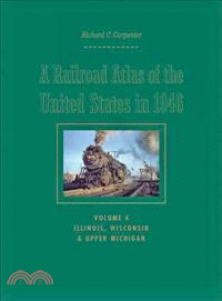
With his meticulously crafted, hand-drawn maps of America’s complex and extensive railroad network, Richard C. Carpenter recaptures a time when steam locomotives were still king and passenger trains s
With stunning photos, detailed maps, and infographics, Amy Cherrix takes readers on a trip into the eye of the storm of hurricane danger zones as she chronicles a team of daring NASA scientists looking to discover the future of the hurricane forecast.Ten million Americans live in hurricane danger zones, but how do we know if or when to evacuate? We must predict both when a storm will strike and how strong it will be. A daring NASA earth science mission may have finally found a way to crack this hurricane code.Dr. Scott Braun is the principal investigator for the Hurricane and Severe Storm Sentinel mission (HS3), which flies repurposed military drone over hurricanes so that scientists can gather data. But the stakes are high and time is running out.In the first Scientists in the Field book entirely about weather, meet the NASA team on the cutting edge of meteorological field science.
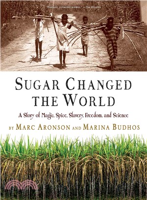
When this award-winning husband-and-wife team discovered that they each had sugar in their family history, they were inspired to trace the globe-spanning story of the sweet substance and to seek out the voices of those who led bitter sugar lives. The trail ran like a bright band from religious ceremonies in India to Europe’s Middle Ages, then on to Columbus, who brought the first cane cuttings to the Americas. Sugar was the substance that drove the bloody slave trade and caused the loss of countless lives but it also planted the seeds of revolution that led to freedom in the American colonies, Haiti, and France. With songs, oral histories, maps, and over 80 archival illustrations, here is the story of how one product allows us to see the grand currents of world history in new ways. Time line, source notes, bibliography, index.
Mixing processes occur in many technological and natural applications, with length and time scales ranging from the very small to the very large. The diversity of problems can give rise to a diversity of approaches. Are there concepts that are central to all of them? Are there tools that allow for prediction and quantification? The authors show how a variety of flows in very different settings possess the characteristic of streamline crossing. This notion can be placed on firm mathematical footing via Linked Twist Maps (LTMs), which is the central organizing principle of this book. The authors discuss the definition and construction of LTMs, provide examples of specific mixers that can be analyzed in the LTM framework and introduce a number of mathematical techniques which are then brought to bear on the problem of fluid mixing. In a final chapter, they present a number of open problems and new directions.
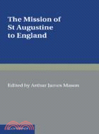
Originally published in 1897, this book offers a selection of writings relating to St Augustine's journey to England, and was created to mark the thirteenth centenary of the journey. The text is divided into main two sections: the first section contains documents from around the time of the journey, provided in both English translation and the original Latin; the second section contains four essays written specifically for the text, covering diverse aspects of the journey and providing background information on it. There are extensive notes throughout, together with maps and a chronological table. This informative book will be of value to anyone with an interest in Augustine, British history and the development of Christianity.
The Great American Bank Robbery maps out in detail exactly how Washington social engineers and their accomplices reshaped banking regulations and housing policies and gutted time-tested underwriting s
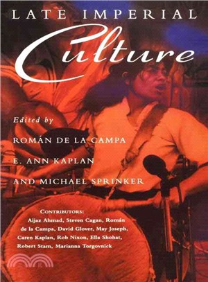
Spanning time and space from late Victorian Britain and Ireland to postwar America and Latin America, Late Imperial Culture maps crucial regions in the terrain of imperial cultural practices including