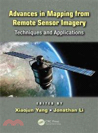
Advances in Mapping from Remote Sensor Imagery ─ Techniques and Applications
商品資訊
商品簡介
Advances in Mapping from Remote Sensor Imagery: Techniques and Applications reviews some of the latest developments in remote sensing and information extraction techniques applicable to topographic and thematic mapping. Providing an interdisciplinary perspective, leading experts from around the world have contributed chapters examining state-of-the-art techniques as well as widely used methods.
The book covers a broad range of topics including photogrammetric mapping and LiDAR remote sensing for generating high quality topographic products, global digital elevation models, current methods for shoreline mapping, and the identification and classification of residential buildings. Contributors also showcase cutting-edge developments for environmental and ecological mapping, including assessment of urbanization patterns, mapping vegetation cover, monitoring invasive species, and mapping marine oil spills—crucial for monitoring this significant environmental hazard.
The authors exemplify the information presented in this text with case studies from around the world. Examples include:
- Envisat/ERS-2 images used to generate digital elevation models over northern Alaska
- In situ radiometric observations and MERIS images employed to retrieve chlorophyll a concentration in inland waters in Australia
- ERS-1/2 SAR images utilized to map spatiotemporal deformation in the southwestern United States
Aerospace sensors and related information extraction techniques that support various mapping applications have recently garnered more attention due to the advances in remote sensing theories and technologies. This book brings together top researchers in the field, providing a state-of-the-art review of some of the latest advancements in remote sensing and mapping technologies.
作者簡介
Xiaojun Yang is a tenured faculty member with the Department of Geography at Florida State University, USA. His research focuses on the development of geospatial science and technology to support geographic inquiries in urban and environmental domains. Dr. Yang has performed research for NASA and received grants from the NSF and EPA. He has authored or coauthored more than 80 English publications, including five books with John Wiley, Springer, and CRC/Taylor & Francis.
Dr. Yang has served as a guest editor for several peer-reviewed journals including Photogrammetric Engineering and Remote Sensing, ISPRS Journal of Photogrammetry and Remote Sensing, International Journal of Remote Sensing, Computers, Environment and Urban Systems, and Environmental Management. He currently serves the second term as chair of the International Cartographic Association (ICA) Commission on Mapping from Remote Sensor Imagery (2011–2015) and director of the Cartography and Geographic Information Society (2012–2015).
Jonathan Li is professor of geomatics at the University of Waterloo in Canada. His research interests include remote sensing, mobile mapping, and geographic information systems. Dr. Li has authored more than 190 publications, including five books with Springer and Taylor & Francis. He is vice chair of the International Cartographic Association (ICA) Commission on Mapping from Remote Sensor Imagery (2011-2015), chair of the ISPRS Inter-Commission Working Group V/I on Land-Based Mobile Mapping Systems (2008-2012), and vice chair of the International Federation of Surveyors (FIG) Commission 4 on Hydrography (2011-2014).
主題書展
更多書展本週66折
您曾經瀏覽過的商品
購物須知
外文書商品之書封,為出版社提供之樣本。實際出貨商品,以出版社所提供之現有版本為主。部份書籍,因出版社供應狀況特殊,匯率將依實際狀況做調整。
無庫存之商品,在您完成訂單程序之後,將以空運的方式為你下單調貨。為了縮短等待的時間,建議您將外文書與其他商品分開下單,以獲得最快的取貨速度,平均調貨時間為1~2個月。
為了保護您的權益,「三民網路書店」提供會員七日商品鑑賞期(收到商品為起始日)。
若要辦理退貨,請在商品鑑賞期內寄回,且商品必須是全新狀態與完整包裝(商品、附件、發票、隨貨贈品等)否則恕不接受退貨。


